|
|
|||||
|
|
|||||
|
|
|
|
|
||
|
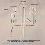
THE CANDELABRA
|
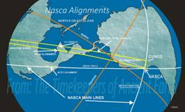
NASCA LINES
ALIGNMENTS |
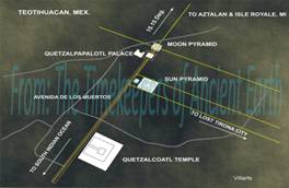
TEOTIHUACAN |
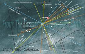
EL INFIERNITO |
||
|
|
|
|
|
||
|
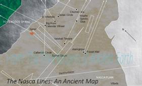
THE NASCA MAP |
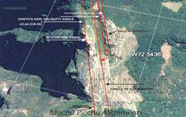
MACHU PICCHU |
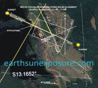
INTIHUATANA SOLSTICE SUN ANGLES |
THE CIRCLE OF
ILLUMINATION SUN ANGLE |
||
|
|
|
|
|
||
|
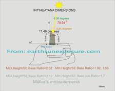
THE INTIHUATANA'S STONE CUT ANGLES TELL ITS AGE |
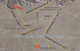
INTIHUATANA SOLAR ANGLES FOUND IN NAZCA LINES |
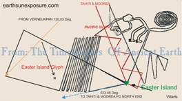
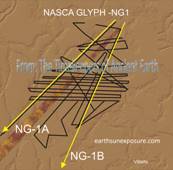
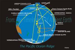
NAZCA MONKEY GLYPH DEPICTS OCEAN RIDGES |
NAZCA GLYPH DEPICTS
OCEAN RIDGES |
||
|
|
|
|
|
||
|
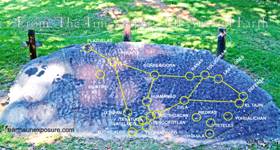
THE JUDACULLA ROCK IS A MAP OF MEXICAN MONUMENTS |
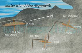
AHU KOTE RIKU'S DIRECTION POINTS TO THE TRELLEBORG AND OTHER SITES |
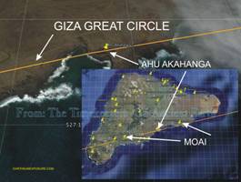
AHU AKAHANGA'S DIRECTION POINTS GREAT CIRCLE TO GIZA |
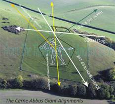
ABBAS GIANT'S MACE DIRECTION POINTS 2nd CIRCLE TO GIZA |
||
|
|
|
|
|
||
|
So. PACIFIC
OCEAN RIDGE |
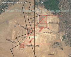
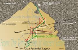
GIZA LAYOUT
AND So.PACIFIC OCEAN RIDGE |
GIZA PYRAMID MEASUREMENTS |
TIHUANAKU AKAPANA PYRAMID'S BASE = GIZA LAYOUT |
||
|
|
|
|
|
||
|
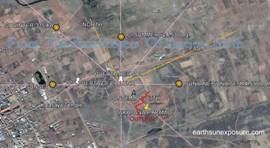
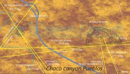
CHACO CANYON
PUEBLOS |
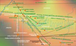
HOVENWEEP PUEBLOS DUE
NORTH FROM AHU VINAPU |
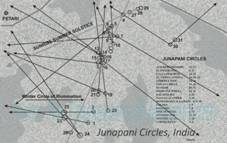
JUNAPANI CIRCLES MAP THE LOCATION OF 17 ARCHAEOLOGICAL SITES |
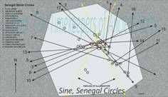
SINE SENEGAL
CIRCLES MAP THE LOCATION OF 17 ARCHAEOLOGICAL
SITES |
||
|
|
|
|
|
||
|
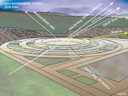
SACSAYHUAMAN'S SUN DIAL
POINTS TO EL CARACOL AND NAZCA |
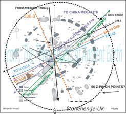
STONEHENGE
ALIGNS WITH THE SUN DIAL, NAZCA, ABBAS GIANT, YONAGUNI, AVEBURY |
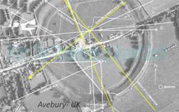
AVEBURY ALIGNS WITH
THE SUN DIAL, MORAY INCA, AZTALAN, AHU KO TE RIKU |
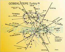
GÖBEKLI TEPE ALIGNS WITH JERASH, AHU URURANGA, CHICHEN ITZA, HOCHOB, TONTINA, SINE CIRCLES |
||
|
Copyright©2014-2015 |
The Archaeology of time measurement - Earth Sun Exposure |
Web page design: villarts@charter.net |
|||